How the Nile Made Egypt Possible
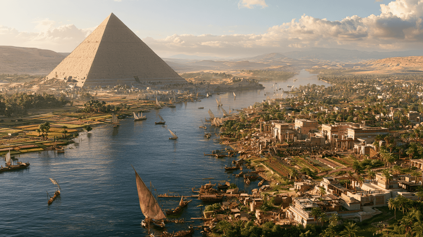
Fly over northeastern Africa today and the pattern is impossible to miss: a thin green ribbon cutting through hundreds of miles of tan and brown desert, as if someone had drawn a single confident line across a blank page. That ribbon is the Nile, and for more than three thousand years it supported one of the most stable and long-lived civilizations in human history.
The puzzle is not that a river valley could support farming. Rivers have supported agriculture on every continent. The puzzle is why this river, in this place, produced something so different from its neighbors: a civilization that built pyramids while other regions were still assembling small farming villages, and that maintained a recognizable political and cultural identity for a span of time longer than separates us today from the fall of Rome.
The answer has less to do with Egyptian genius and more to do with an unusually rare set of natural conditions. Understanding why Egypt emerged where and when it did means understanding what the Nile actually did, year after year, and what it did not do.
A Civilization Squeezed Between Two Deserts
Ancient Egypt occupied a strange kind of geography. To the east and west lay the Sahara and the Eastern Desert, two of the driest, most difficult environments on Earth. Between them ran a narrow strip of cultivable land, in most places only a few miles wide, fed entirely by a single river flowing north from the highlands of East Africa.
This geography did something unusual: it isolated Egypt without starving it. The deserts made large-scale invasion difficult and expensive for most of Egyptian history, unlike the more exposed river valleys of Mesopotamia, which sat at the crossroads of Near Eastern trade routes and repeated foreign incursions. At the same time, the Nile itself connected the entire valley into a single navigable corridor, from the first cataract near modern Aswan down to the Mediterranean.
Egypt, in other words, had the protection of isolation and the connectivity of a river highway at once. Few ancient regions had both.
The River That Farmed Itself
The core of Egypt’s advantage was not simply that the Nile provided water. Many rivers provide water. What made the Nile distinctive was the mechanism of its annual flood, a process ancient Egyptians called the inundation.
Each summer, monsoon rains over the Ethiopian highlands and the Nile’s other upstream sources sent a surge of water downstream. By late summer, the river rose over its banks across the Egyptian floodplain, and when it receded weeks later, it left behind a layer of dark, mineral-rich silt.
This silt functioned as a natural, self-renewing fertilizer. Farmers did not need to rotate crops extensively or worry about long-term soil exhaustion, because the river replenished the nutrients every year. The Greek historian Herodotus is often credited with calling Egypt “the gift of the river,” a phrase that captures a basic truth even if its precise attribution is debated among historians: the flood did the work that irrigation systems in most other early civilizations had to build by hand.
This is worth pausing on, because it explains something easy to miss. Early agricultural states elsewhere spent enormous effort maintaining canals, levees, and irrigation infrastructure, often under conditions where rivers behaved unpredictably. Along the Nile, one natural cycle handled fertilization automatically, freeing labor and resources for other purposes: monumental construction, administration, and the arts that made Egyptian civilization recognizable to us today.
Why Predictability Mattered More Than Fertility
Fertile soil alone does not create a stable civilization. Predictability does.
The Tigris and Euphrates rivers of Mesopotamia, often discussed alongside the Nile as a cradle of early civilization, were considerably less reliable. Their floods arrived at irregular times, varied enormously in size from year to year, and could destroy as easily as nourish. Mesopotamian societies had to build extensive irrigation and flood-control systems and adapt to genuine uncertainty about whether a given year’s harvest would succeed.
The Nile’s flood, by contrast, followed a relatively consistent annual rhythm for most of Egyptian history. Ancient Egyptians developed tools like the nilometer, a graduated measuring device built into riverbanks and temple structures, specifically to track the flood’s height each year, because the height mattered enormously. A flood too low meant insufficient irrigation and the risk of famine. A flood too high could destroy villages and stored grain. But within a workable range, the pattern repeated reliably enough that Egyptian society could plan around it: farming seasons, tax assessments, labor schedules, and religious festivals were all organized around the flood’s expected arrival.
This predictability did something subtle but important. It allowed Egyptian rulers to develop long-range administrative systems, because the agricultural calendar was, within limits, calculable in advance. A society that can reasonably predict its harvest can build granaries, plan large public works, and support a class of administrators, priests, and craftsmen who do not themselves farm. Predictability, more than raw fertility, is what allowed Egypt’s surplus to become political power rather than mere subsistence.
One River, One Kingdom
The Nile did not only grow Egypt’s food. It also built Egypt’s government.
Before roughly 3100 BCE, the Nile Valley consisted of separate regional communities, generally grouped by historians into an Upper Egyptian region to the south and a Lower Egyptian region near the Nile Delta in the north. The traditional account credits a ruler often identified with Narmer with unifying these regions into a single kingdom, a narrative preserved partly through artifacts like the Narmer Palette. Egyptologists continue to debate the exact process of unification and how much of it reflects a single dramatic conquest versus a longer, more gradual political consolidation.
What is less disputed is why unification made sense in the first place. The Nile functioned as a single transportation corridor linking the entire valley, with a current flowing north and prevailing winds that generally allowed boats to sail south. This meant that a government based almost anywhere along the river could move troops, grain, tax officials, and building materials up and down the valley relatively efficiently, at least by the standards of the ancient world.
Contrast this with regions where geography fractures naturally into isolated valleys or competing river systems. Egypt’s single river corridor made large-scale, centralized rule a practical possibility. This helps explain why Egypt achieved political centralization earlier and more durably than many other early civilizations, and why Egyptian identity remained tied to “the Two Lands,” Upper and Lower Egypt, symbolically united under one crown for millennia.
What Popular Memory Gets Wrong
There is a persistent popular image of ancient Egypt as a land of easy abundance, where the Nile did the work and Egyptians simply harvested the results. This picture is misleading in an important way.
The river created the conditions for agricultural surplus, but it did not create irrigation canals, build dikes, coordinate planting schedules, or organize the labor needed to manage floodwaters across an entire valley. Egyptian farmers and administrators built basin irrigation systems that channeled floodwater into fields and controlled its release. Managing this system required cooperation across villages and, eventually, the coordination of a centralized state.
This is a point worth making clearly: the Nile provided a rare natural advantage, but Egyptian civilization still had to organize itself to use that advantage effectively. Other regions with rivers did not automatically produce comparable states. The flood gave Egypt raw material. Egyptian institutions turned that material into one of the ancient world’s most durable civilizations.
The Limits of the Gift
It would be inaccurate to describe the Nile as an unconditional blessing. The same flood that sustained Egypt for centuries could also fail it, and when it did, the consequences were severe.
Historians and archaeologists have linked a series of unusually low Nile floods to periods of political fragmentation and instability, including the difficult transition sometimes called the First Intermediate Period, roughly a century after the end of Egypt’s Old Kingdom. Written sources from this era, including texts often referred to collectively as laments, describe famine, social breakdown, and a loss of central authority, although historians caution that these texts likely exaggerate conditions for rhetorical or moral effect rather than functioning as precise historical records.
The broader point stands regardless of how literally those texts should be read: Egyptian civilization was never independent of the Nile’s behavior. Its stability was real, but it was not guaranteed. When the flood faltered for multiple consecutive years, the political and social order that depended on it could falter as well. Egypt’s long-term resilience came not from never facing crisis, but from the valley’s underlying advantages, isolation, connectivity, and generally reliable flooding, that allowed the civilization to recover and reconsolidate after disruptions that might have permanently fragmented a less favorably situated society.
Why This Still Matters
The relationship between Egypt and the Nile did not end with antiquity. It continues today, transformed by modern engineering. The completion of the Aswan High Dam in 1970 ended the annual flood cycle that had shaped Egyptian agriculture for millennia, replacing it with controlled, year-round irrigation and hydroelectric power. This brought real benefits, including flood control and more predictable water supply, but it also ended the natural silt deposition that had fertilized Egyptian fields for thousands of years, requiring farmers to rely increasingly on artificial fertilizers.
Understanding why Egyptian civilization depended so completely on the Nile also helps explain a very current geopolitical reality. Egypt today remains almost entirely dependent on the Nile for fresh water, which is part of why ongoing disputes over the Grand Ethiopian Renaissance Dam, built upstream in Ethiopia, have become a matter of serious national concern for Egyptian policymakers. The geographic dependency that built ancient Egypt has not disappeared. It has simply taken a modern diplomatic form.
The deeper lesson of Egypt’s origin is not that geography determines history in some simple, mechanical way. It is that particular environments create particular possibilities, and that human societies still have to build the institutions capable of realizing them. The Nile did not build Egypt’s pyramids, write its literature, or organize its bureaucracy. It created a narrow, fertile, predictable, and defensible corridor of land, and left the rest to the people who learned to live along it.
That distinction, between what a river makes possible and what a civilization chooses to build on top of it, is why Egypt’s story remains one of the clearest examples in history of geography shaping human destiny without ever fully determining it.